Google-backed FireSat wildfire detection satellites launch amid North American smoke
Published by AINave Editorial • Reviewed by Ramit
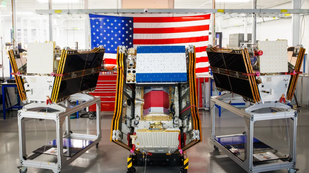
The first three operational FireSat wildfire detection satellites launched on July 7, 2026, from Vandenberg Space Force Base aboard a SpaceX Falcon 9 rocket. Backed by Google and led by the nonprofit Earth Fire Alliance, the constellation is designed to detect small fires that existing satellites miss, using infrared sensors and AI-powered processing to deliver near real-time imagery to emergency responders.
What happened
As smoke from hundreds of wildfires blanketed Canada and the United States, the FireSat program reached a key milestone. Three microsatellites built by a Bay Area company launched successfully, expanding a global initiative to create an unprecedented wildfire dataset. The program aims to detect fires as small as 5 by 5 meters, a significant improvement over current satellite systems that often miss small or cool fires. The launch comes as wildfire smoke from Canada and northern Minnesota caused air quality issues in major cities like Toronto, Boston, and New York.
Why AI builders should care
For AI builders, FireSat represents a real-world deployment of AI-powered satellite imagery analysis at scale. The system uses machine learning models trained to identify fire signatures from infrared data, enabling faster detection than traditional methods. This creates opportunities for integrating FireSat data into alert systems, smoke forecasting models, and resource allocation tools. The collaboration between Google, Earth Fire Alliance, and space startups also sets a precedent for how AI and satellite data can be combined for environmental monitoring. The Bezos Earth Fund committed $26 million to the constellation, signaling growing investment in this space.
Practical implications
Near real-time wildfire imaging could lead to faster alerts for communities and better deployment of firefighting resources. Public tools like AirNow and FireSmoke.ca currently rely on satellite detections that can be obscured by clouds or smoke. FireSat's dedicated infrared sensors may improve detection even under some of those conditions, though limitations remain. For developers building emergency response or climate tech products, FireSat data could become a new data source for models that predict fire spread or air quality impacts. The FireSat research site notes that a pathfinder satellite already detected a small, cool fire in the Western U.S. that existing systems missed.
Caveats
Several caveats apply. The system's exact detection thresholds and real-time integration timelines are not yet publicly specified. Smoke and cloud cover can still obscure satellite detections, limiting coverage. The initial three satellites cover North America, with global expansion planned but not yet scheduled. Official specifications from Earth Fire Alliance or Google may differ from early press descriptions. AI builders should treat current capabilities as directional until confirmed by operational data.
FAQs
Sources
- Google-backed satellites for wildfire detection launch as smoke chokes US, Canada
- FireSat Satellites Launch to Catch Small Wildfires Early — for(geeks)
- Smoke Forecast - FireSmoke.ca
- Wildfire smoke is choking Canada, Great Lakes and Northeast
- AirNow Fire and Smoke Map
- New FireSat satellites promise faster wildfire detection over California and beyond
- FireSat satellites launch to improve wildfire detection from space
- Nonprofit, space startup launch global wildfire detection satellite network
- 'Game-changing' satellites launch from CA to detect and track wildfires
- Greece Became First Nation to Use Dedicated Satellites for Wildfire...
- Nonprofit, space startup launch global wildfire detection satellite network
- 3 new FireSat satellites launch to help detect wildfires with AI
- Google-Backed FireSat Satellites Launch as Wildfire Smoke ...
- FireSat - Wildfires - sites.research.google
- Bezos Earth Fund Commits $26 Million to Wildfire Detection &…